Casestudy
How KPF Reimagined 42nd Street with AI-Powered Visualization
The Street: A corridor that connects everything, yet belongs to no one
Running the full width of Manhattan, 42nd Street links Grand Central Terminal to the Port Authority Bus Terminal, passing through five entirely different urban worlds: a west-side residential neighbourhood, the entertainment concentration of Times Square, the densest office district in North America, Bryant Park, and a quieter eastern office cluster.
No other street in the country does this. No other street packs this much density, this many transit riders, this range of use into a single corridor.
“42nd Street stands apart as a vivid reflection of New York itself, embodying the city’s complexity and vitality within a single corridor.”
The Problem: Five owners. No vision.
Despite its extraordinary character, 42nd Street has languished, wide roadways choked with traffic, overcrowded sidewalks, virtually no greenery outside of Bryant Park. Even as other New York streets were being pedestrianized, greened, and rebuilt for people, 42nd Street was treated as an afterthought.
The reason is structural. The street crosses five Business Improvement Districts, each with its own mandate. None of them owns 42nd Street. None of them has the scope to take in its importance as a whole.
The Complexity: Not one neighborhood: five, stacked in six miles
What makes 42nd Street so hard to design for is also what makes it extraordinary: its density peaks and valleys are unlike anything else in the city. Clusters along the corridor reach up to 28 FAR; for reference, Greenwich Village has an FAR of 3.5. Each cluster, just four to six blocks long, contains as much built area as entire neighbourhoods elsewhere.
This is not a single design problem. It is five design problems that share a spine each with different users, different pressures, and different futures. Any proposal for 42nd Street has to hold all of them at once.
The Proposal: Five interventions. One coherent corridor.
KPF’s vision, developed and presented through the KPF Positions series, treats each segment of 42nd Street on its own terms, then links them with a single transit spine that runs river to river.
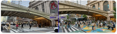
Far east end, pocket parks. Parking converted to human scale green space, a model already proven in San Francisco and cities across Europe.
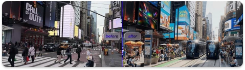
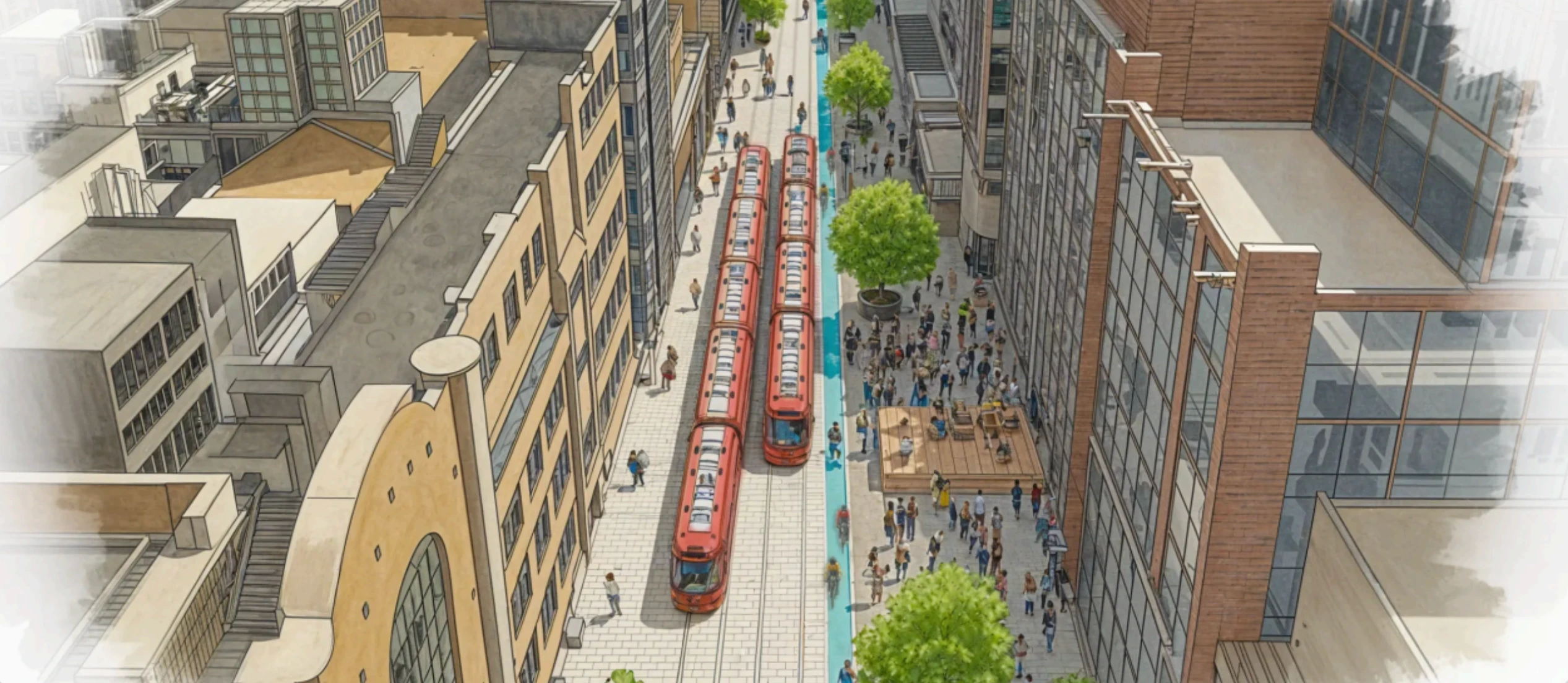
Times Square: a dynamic plaza, not a roadway. Double the pedestrian realm by limiting traffic to streetcar and bike lanes. This stretch becomes an extension of Times Square’s public life; seating, greenery, space for performance and gathering.
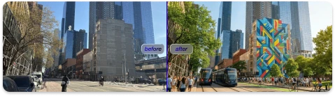
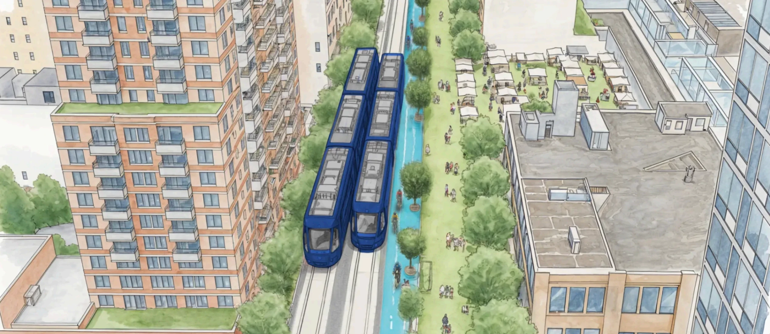
West Side Residential: 100,000+ sq ft of new parkland. Traffic consolidated to streetcar and bike lanes on one side of the street, freeing over 100,000 sq ft of new public space roughly half the size of Union Square. Outdoor dining, recreation, community markets. A neighbourhood that feels like one.
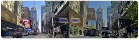
Midtown office clusters, flexible streets. Pedestrianize portions of 42nd Street during peak hours and lunchtime. Shaded seating and vegetation where cars once queued. East of Grand Central: protected bike lanes, a consistent street tree canopy, pocket seating for office workers.
A river-to-river streetcar + new ferry terminals. A dedicated streetcar running the length of 42nd Street, terminating at new ferry terminals on the East and Hudson Rivers. At a fraction of the cost of subway extensions, this intervention would connect Queens, Brooklyn, and New Jersey to the heart of Midtown and reconnect Manhattan to its waterfront.
The scale of the challenge: A proposal that needed to be seen to be believed
Telling this story required more than diagrams. Five neighbourhoods. Five distinct before/after visions. A transit system spanning the width of Manhattan. Aerial views, street-level perspectives. and district-scale analysis all consistent, all compelling, all ready for the room.
This is the kind of proposal where the visualization is the argument. Where showing what 42nd Street could become is inseparable from making the case that it should.
“Now is the moment to give it the coordinated care and visionary design worthy of its title as the greatest street in the world.”
The world’s leading architecture firms are telling stories like this.
KPF. BIG. ZHA. The proposals that shape cities aren’t won on data alone, they’re won when a vision becomes impossible to unsee.